OfflineMaps provides you with access to an extensive collection of maps, ensuring a seamless and private navigation experience. With **no advertisements, no data sharing or monetization, no analytics, and no third-party libraries**, you can enjoy a clean and focused mapping tool.
Tired of waiting for maps to load? Use All-In-One OfflineMaps! **Once displayed, maps are stored locally and remain accessible, even without a network connection**, making your journeys smoother and more efficient.
- **Want more than just roads on your maps?** OfflineMaps has you covered with a variety of options to meet your needs.
- **Traveling to areas with poor network coverage?** No problem—everything stays available offline.
- **Planning to go abroad?** Never get lost again with OfflineMaps.
- **Concerned about data usage limits?** OfflineMaps helps reduce your data consumption.
★★ **Maps** ★★
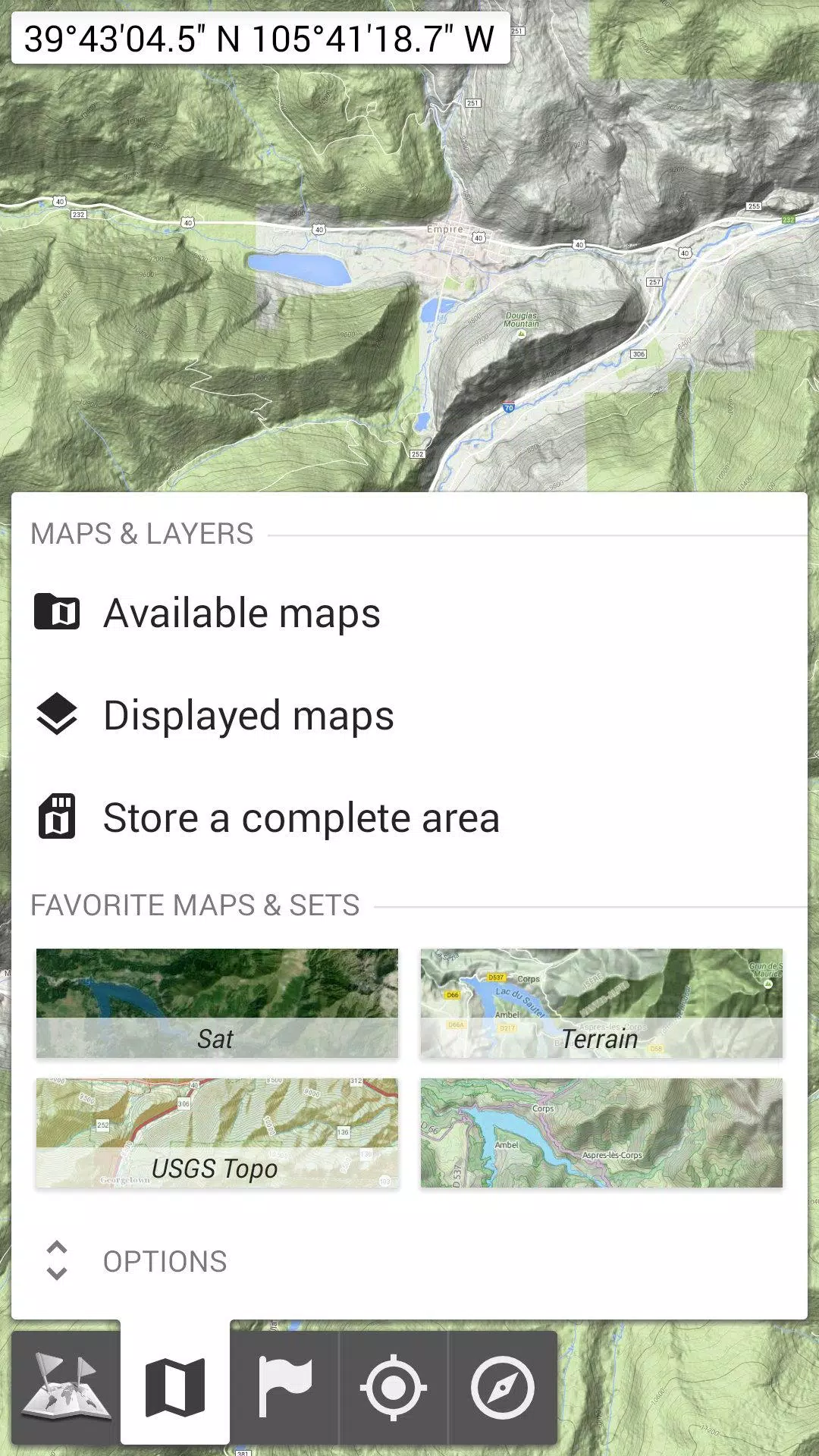
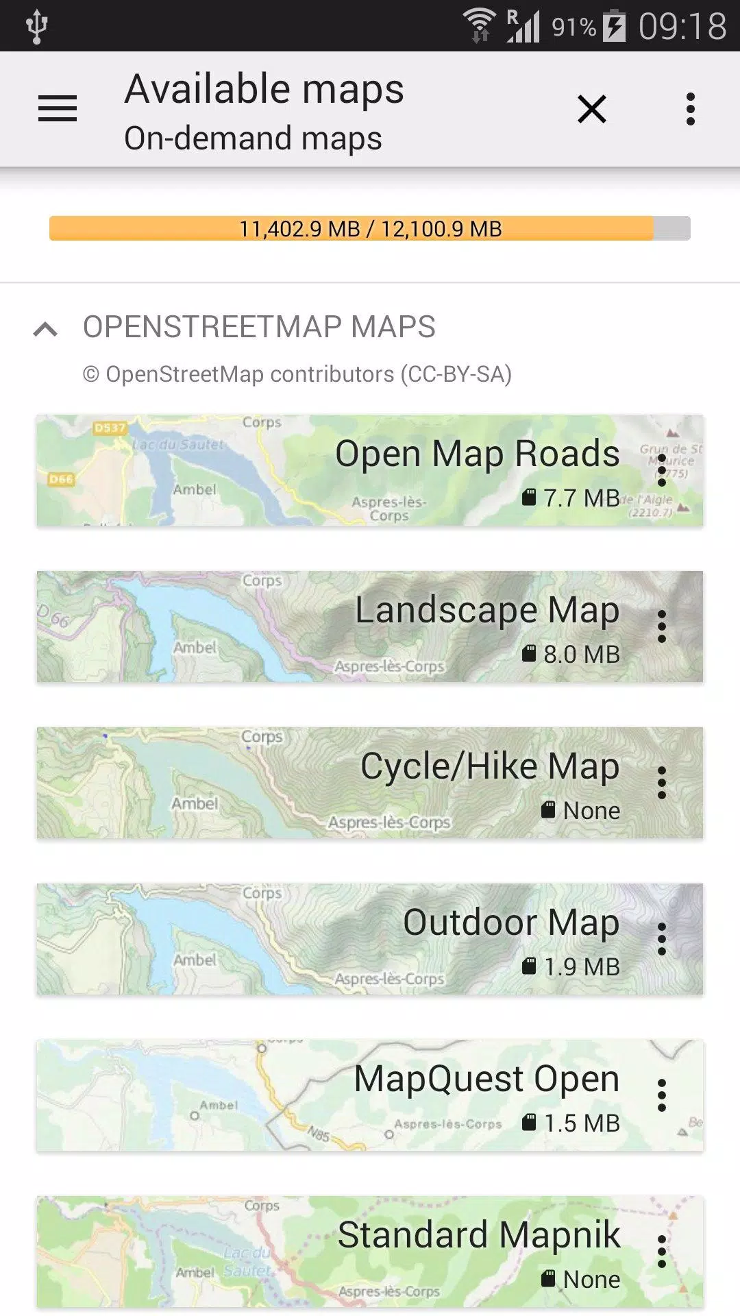
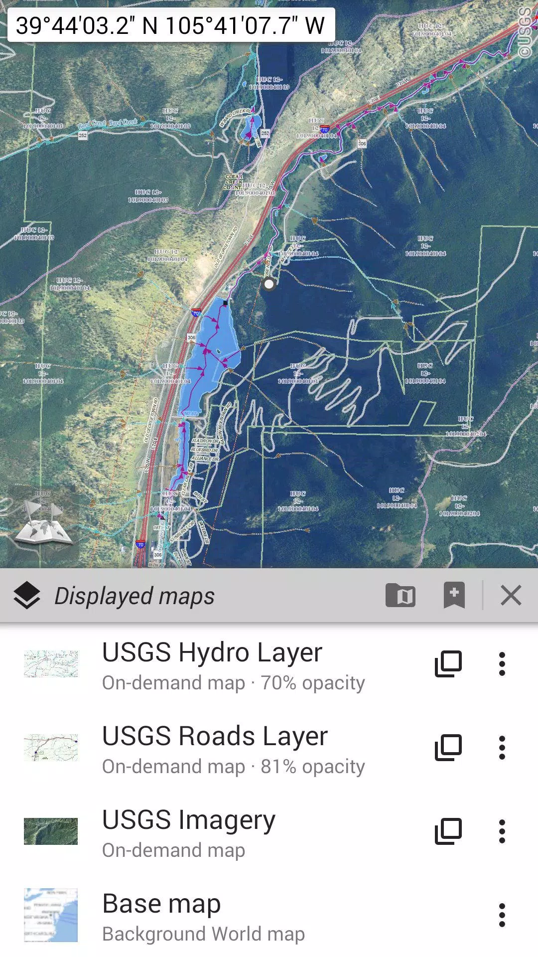
Explore a wide range of maps, from traditional road maps and detailed topographic maps to aerial (satellite) imagery. You can also enhance your maps with various layers such as OpenStreetMap (Roads, Topo), USGS National Map (Hi-res topo, Aerial imagery), and Worldwide Military Soviet topo maps, among others.
- All maps can be layered with precise opacity control for a customized view.
- Easily select and store large areas with just a few clicks.
- Manage your stored map data effortlessly, with the ability to clear space as needed.
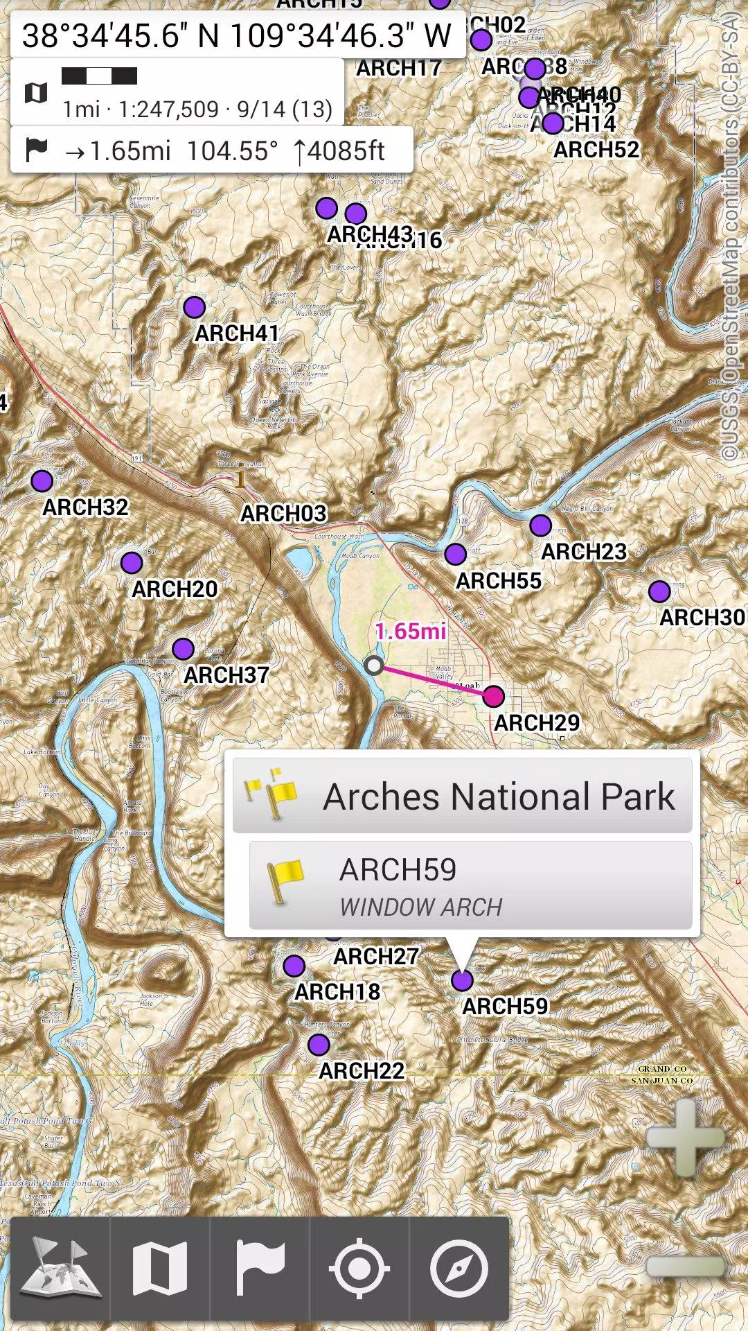
★★ **Display, Store, and Retrieve Unlimited Placemarks** ★★
Enhance your maps by adding waypoints, icons, routes, areas, and tracks. Manage these items seamlessly with the powerful SD-Card Placemarks Explorer.
★★ **On-Map GPS Location & Orientation** ★★
See your real-time location and direction directly on the map, which can be rotated to align with your actual orientation (depending on device capabilities). Turn GPS features on or off to conserve battery life.
Additionally, OfflineMaps offers:
- Metric, imperial, and hybrid distance units.
- GPS coordinates in various formats including Latitude/Longitude, UTM, MGRS, USNG, OSGB Grid, Irish Grid, Swiss Grid, Lambert Grids, DFCI Grid, and QTH Maidenhead Locator System.
- Ability to import hundreds of coordinate formats from spatialreference.org.
- On-map grid displays.
- Full-screen map view.
- Multi-touch zoom functionality.
- And more...
★★ **Need More?** ★★
For the ultimate outdoor adventure, consider **AlpineQuest Off-Road Explorer**, built on the foundation of All-In-One OfflineMaps. It includes a robust GPS Track Recorder and additional features tailored for adventurers. Learn more at alpinequest.net/google-play.