Your Ultimate Guide to Hiking, Cycling, Skiing, and Exploring the Alps
Whether you're an avid hiker, a passionate cyclist, or a skiing enthusiast, our comprehensive guide is here to help you plan your next adventure. From navigating the Alps by car or public transport to discovering unique trails and scenic routes, we've got you covered. Let's dive into the features that will enhance your outdoor experience.
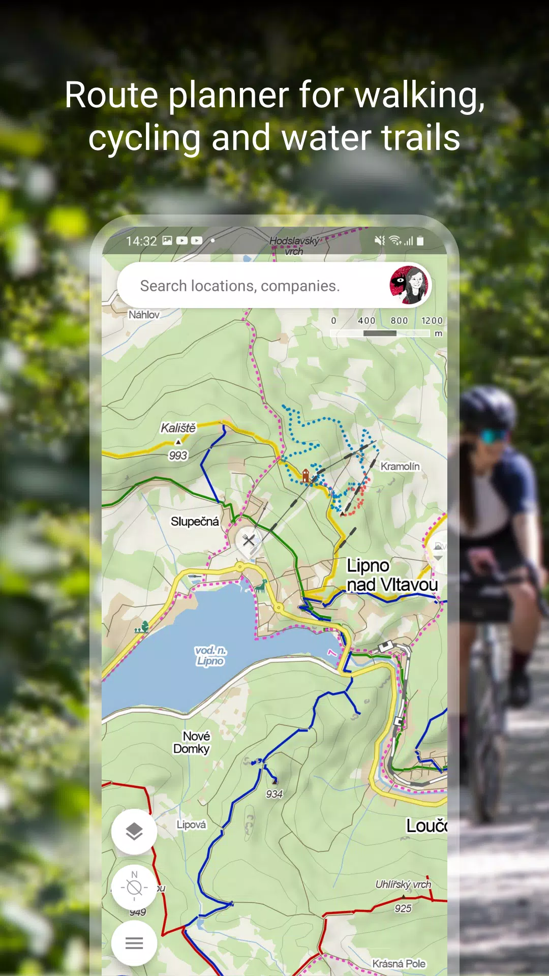
Plan Your Route
Planning your journey has never been easier with our detailed route planning tools:
- Hiking and Cycling Trails: Discover paths tailored to your skill level and interests.
- Cross-Country Skiing and Ski-Alpine Trails: Find the perfect winter routes for an exhilarating experience.
- Unique “Travel Tips” Feature: Plan a trip through the most interesting places in the area for a memorable journey.
- Route Elevation Profile: Understand the terrain ahead with detailed elevation data.
- 5-Day Weather Forecasts: Stay prepared with accurate weather, temperature, wind, and precipitation forecasts for any location on earth.
Browse the Tourist Map of the Whole World
Explore the globe with our extensive tourist map, featuring:
- Hiking Trails, Bike Trails, Singletracks, and Single Trails: Navigate with confidence on a variety of paths.
- Marking of Roads, Mixed Cycle Paths, Unpaved Paths, and Footpaths: Choose the right route for your adventure.
- Hillshade and Ferrata Markings: View detailed hillshade anywhere in the world and assess the difficulty of ferrata routes.
- Educational Trails, Pedestrian Closures, National Park Zones: Learn as you explore and respect the environment.
- Routes for Wheelchair Users: Ensure accessibility for all adventurers.
Switch to Other Map Layers
Enhance your navigation with different map layers:
- Aerial Map of the World: Get a bird's-eye view of your destination.
- Panoramic Images and 3D Views: Explore Czech streets with detailed imagery.
- Winter Maps: Stay updated on cross-country ski trails and ski resorts.
- Traffic Map: Monitor real-time traffic, closures, and parking zones in the Czech Republic.
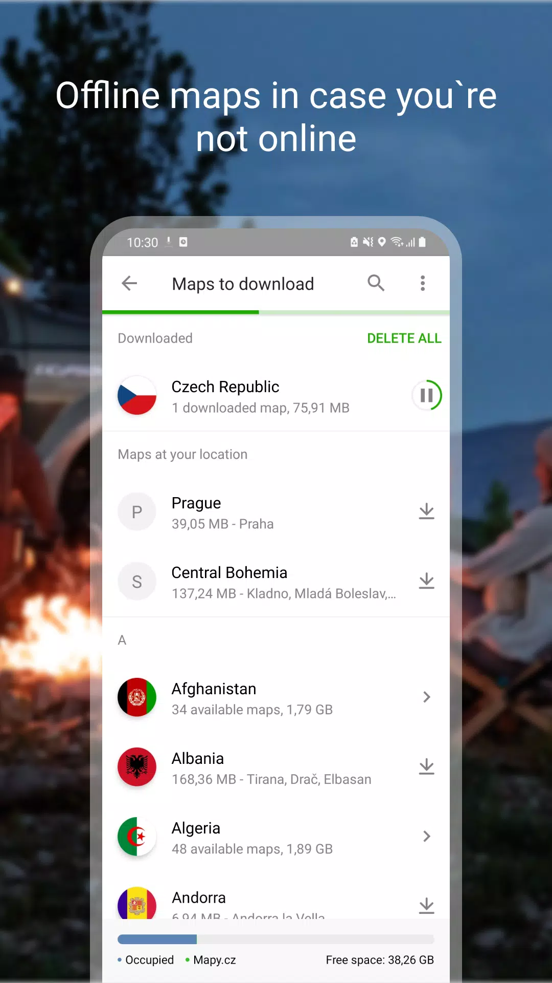
Download Offline Maps
Stay connected even without a signal with our offline map features:
- Offline Tourist Map: Access hiking and cycling trails worldwide.
- Offline Voice Navigation: Navigate as a driver, cyclist, or pedestrian without an internet connection.
- Offline Winter Maps: Explore cross-country skiing trails and ski resorts in the Czech Republic offline.
- Individual Region Downloads: Download specific regions for focused navigation.
- Search and Plan Routes: Find places and plan routes globally, even without a signal.
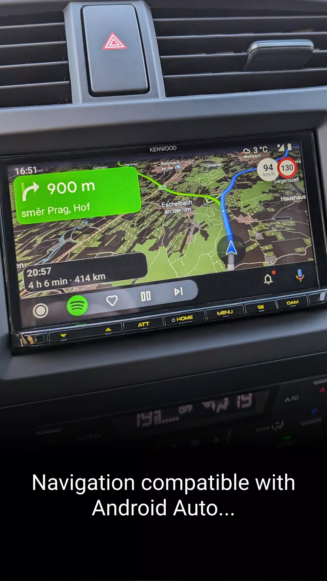
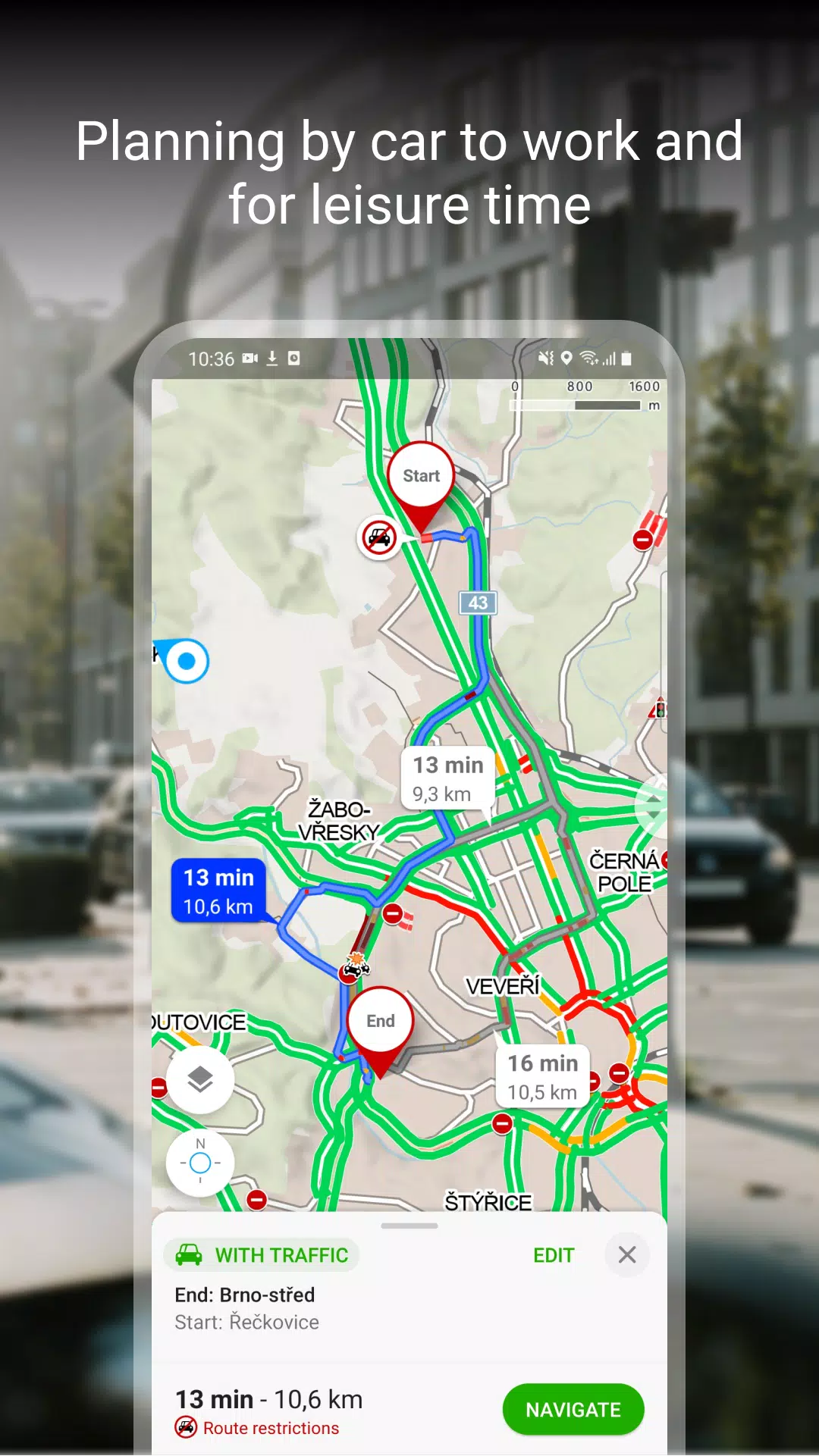
Free Navigation for Drivers, Cyclists, and Pedestrians
Our navigation system offers:
- Clear Lane Instructions: Know exactly which lane to take.
- Highlighted Roundabout Exits: Navigate roundabouts with ease.
- Avoid Toll Lanes: Plan routes to bypass tolls if desired.
- Dark Mode: Reduce glare with a darker interface.
- Share Your Journey: Send arrival time, route, and current location via SMS, email, or chat.
- Android Auto and Apple Car Play: Enjoy navigation on larger in-car displays.
- Speeding Alerts and Speed Cameras: Stay safe and informed in the Czech Republic.
- Real-Time Traffic Updates: Get the latest traffic situation, accidents, and alternative routes in the Czech Republic.
- Accident-Prone Sections and Winter Maintenance: Be aware of sections with frequent accidents and those without winter maintenance.
Save to My Maps
Organize your adventures with our saving features:
- Save Places, Routes, Photos, and Activities: Keep everything in clear folders.
- Track Your Activities: Use Tracker for walking, cycling, running, cross-country skiing, and hiking.
- GPX File Management: Import, export, and upload GPX files seamlessly.
- Synchronize Across Devices: Keep your planned routes synced across all your devices.
Choose by Reviews of Places, Restaurants, and Services
Make informed decisions with:
- Up-to-Date User Photos: See what the place looks like before you go.
- Users' Experiences: Get insights on food, service, ambience, and price.
- Search by Rating: Highlight top-rated establishments for a quality experience.
Recommendations and Tips
To make the most of our app, keep these tips in mind:
- Internet Connection: You'll need an internet connection to download maps.
- Location Services: Turn on location services in your phone settings for accurate navigation.
- Background Location Data: For location sharing, the app will need access to background location data.
- Troubleshooting: Use the form in the app settings for questions or issues.
- Battery Life: Using the app in the background with GPS running can reduce battery life.
- User Community: Join our community at www.facebook.com/Mapy.cz/ to share your experiences, stay updated, and suggest new features.
With our guide, your next adventure in the Alps or around the world is just a few clicks away. Start planning today and experience the great outdoors like never before!