City routes, live traffic, transit routes, parking, offline map and navigation.
We've updated 2GIS to better showcase the vast amount of information we've gathered about cities and companies. The new version features a fresh design, an enhanced search function, improved city updates, and integrates favorites with 2gis.ru.
Services, Addresses, and Companies
2GIS provides detailed information on services available in your area, from utility providers to local amenities like hospitals and post offices. It helps you choose cafes or service centers based on user reviews and photos, displaying their opening hours and contact numbers.
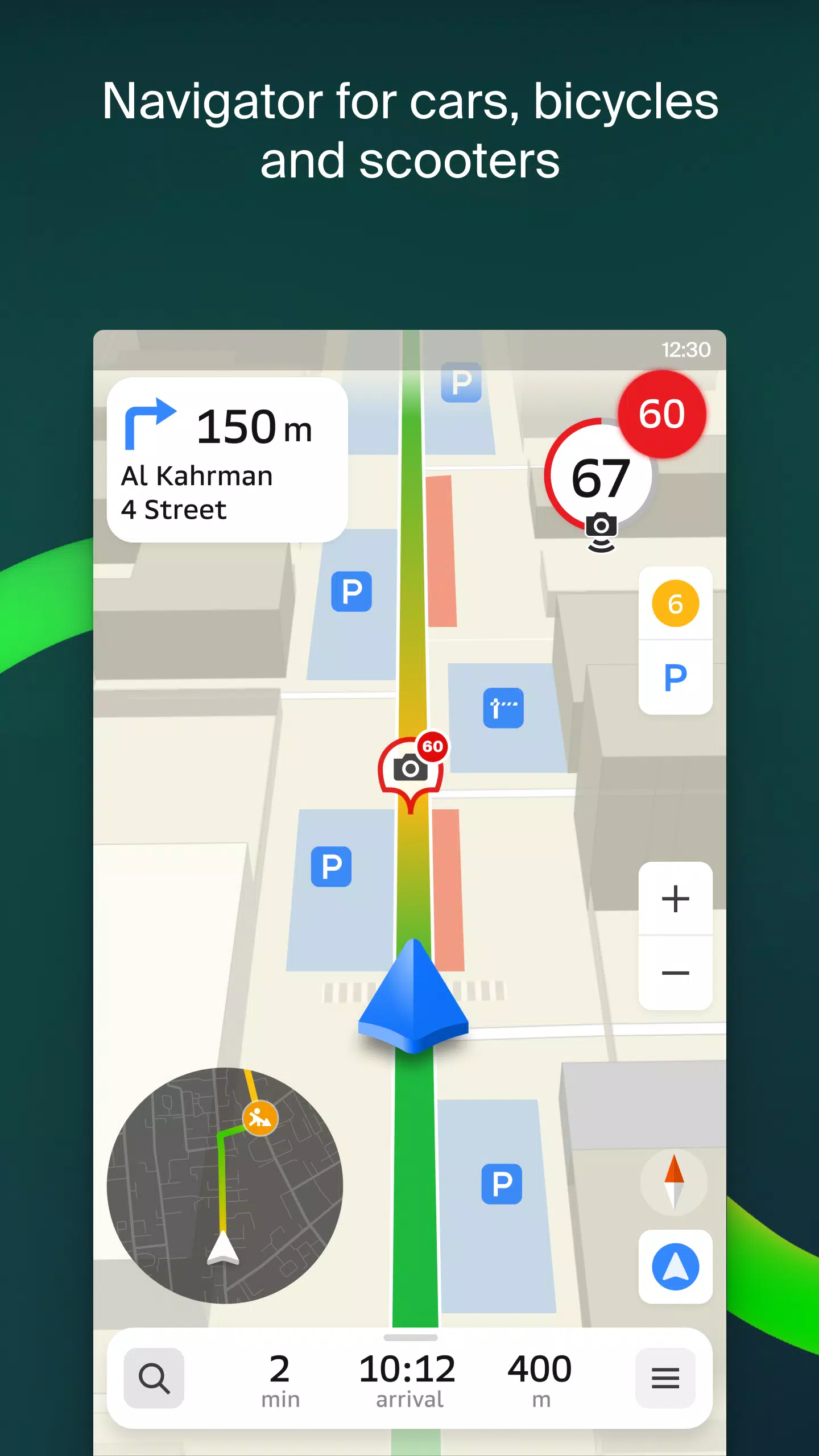
Transport and Navigation
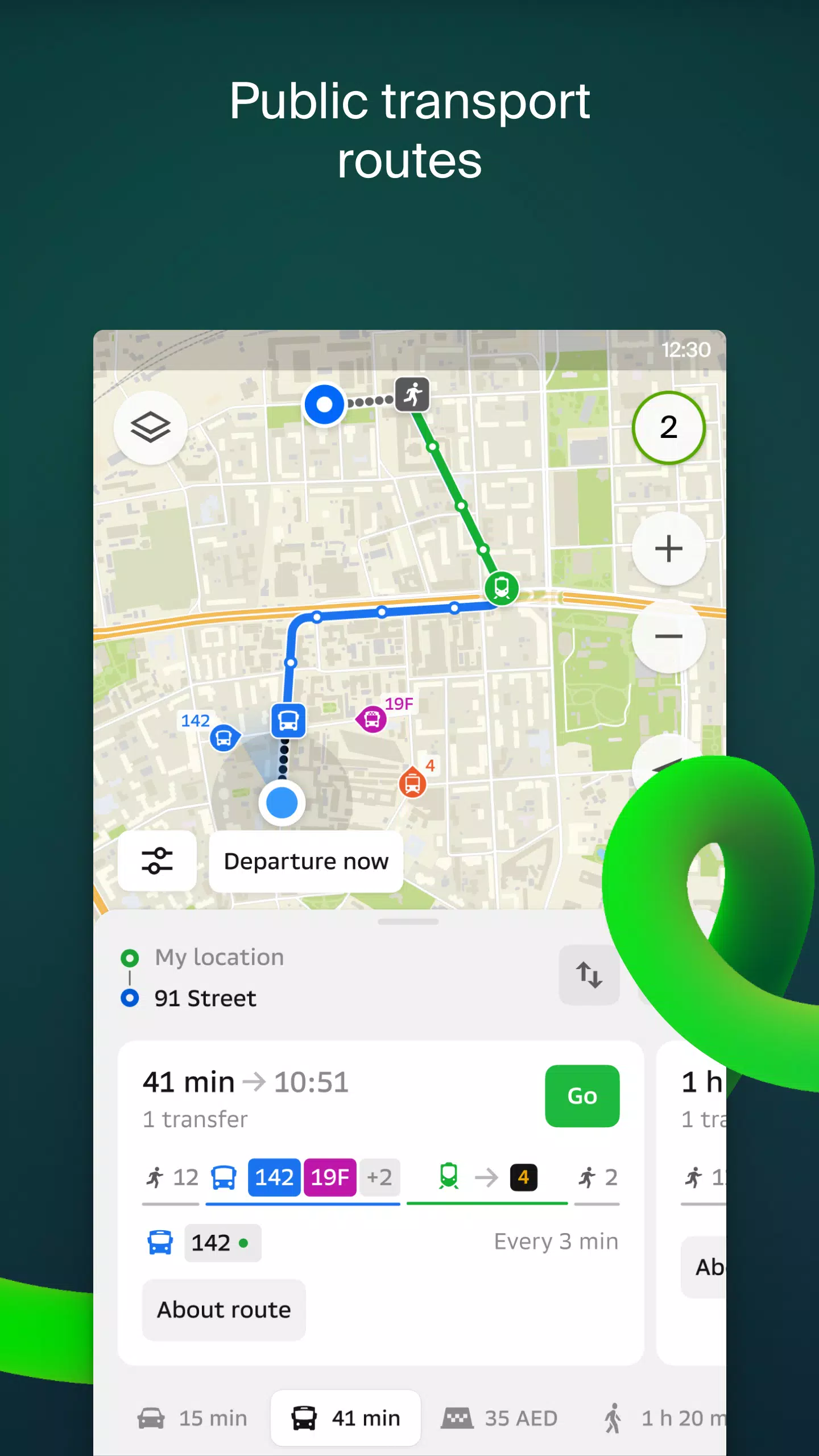
For drivers, 2GIS offers real-time navigation with voice-guided instructions, taking into account traffic conditions and road closures. It dynamically adjusts your route if you stray from the planned path. For public transport users, it provides options for buses, metro, trains, cable cars, and river trams.
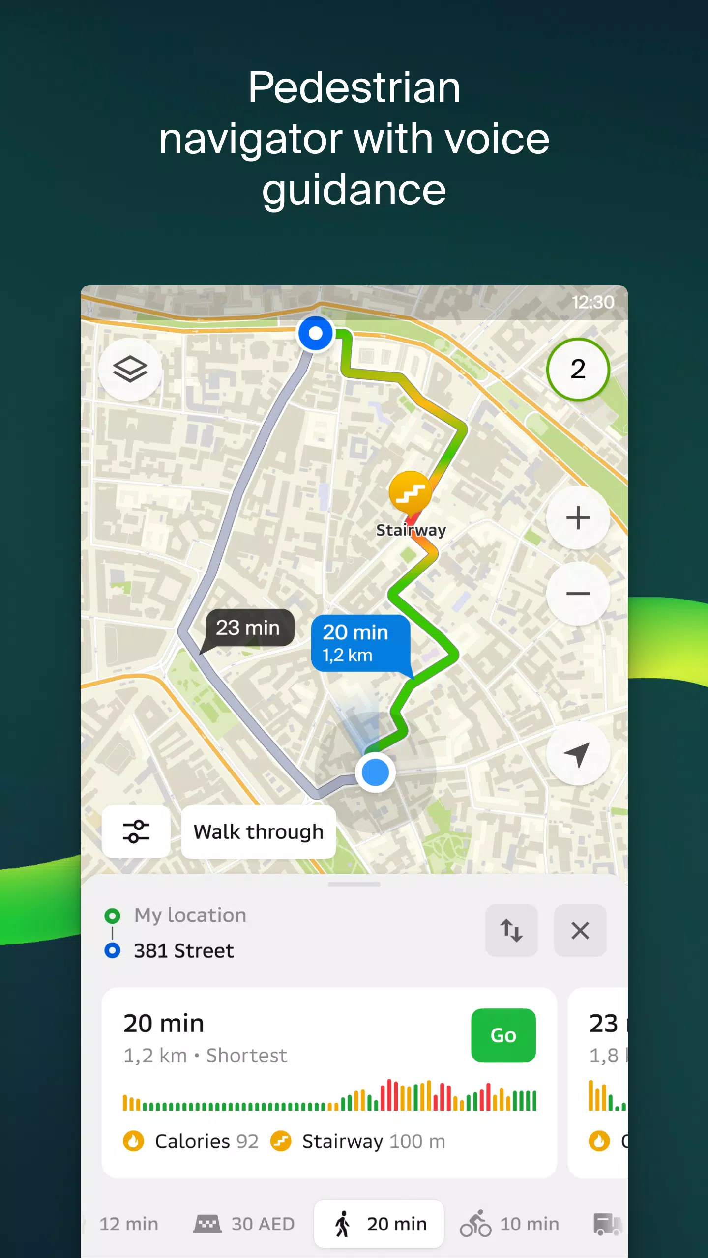
Walking Routes
Our pedestrian navigation system guides you on foot, complete with background operation and voice guidance.
Friends on the Map
With 2GIS, you can track the real-time location of friends and family on the map. You control who can see your location and manage your visibility settings.
Building Entrances
Never wander around looking for an entrance again. 2GIS knows the entry points for over 2.5 million companies and can direct you right to the door, whether you're walking, driving, or using public transport.
Plans of Shopping Centres
Navigate shopping centers effortlessly with 2GIS, which maps out everything from stores and cafes to ATMs and restrooms, helping you plan your visit in advance.
2GIS Beta Notifications Companion App for Smart Watches
For users with Wear OS smartwatches, the 2GIS beta companion app offers on-the-go navigation for walking, cycling, or public transport. It displays maps, provides maneuver hints, and sends vibration alerts when nearing a turn or destination. The app automatically syncs with your phone's navigation and is compatible with Wear OS 3.0 and later.
As a beta tester, you'll receive timely updates as we fix bugs and enhance features, playing a crucial role in shaping the next version of 2GIS, which will be used by millions. You can run the beta alongside the original app, switching between them as needed.
Support: [email protected]
What's New in the Latest Version 6.44.1.559.3
Last updated on Oct 19, 2024
We're thrilled to introduce these updates in our latest version:
— Enhanced road visuals on the main map and during route searches for a more realistic experience. — New Chats for Friends feature, allowing you to communicate directly within the app. — Added notifications when friends are nearby, with the option to disable in settings. — Timely ski lift status updates for winter sports enthusiasts. — Improved walking route calculations for public transport journeys, now in steps.